Roadway Applicability
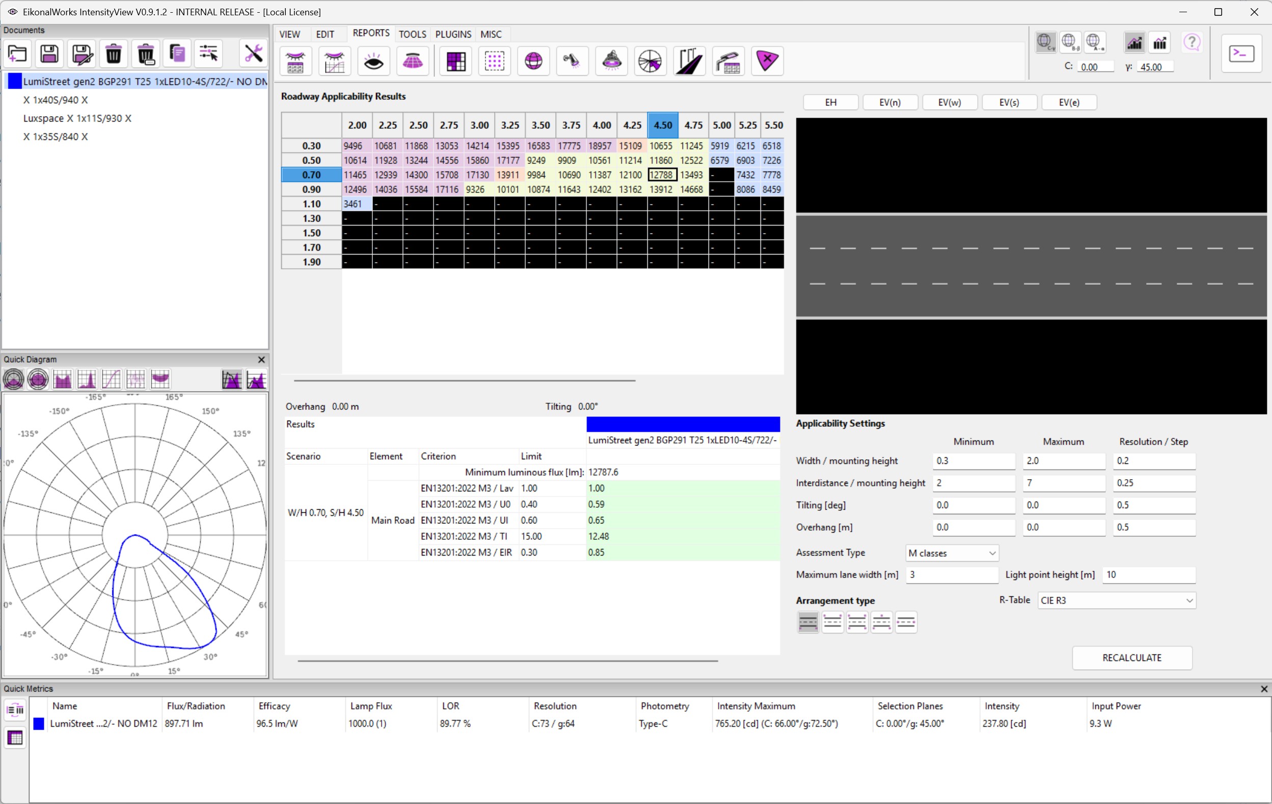
The Roadway Applicability report searches standard roadway arrangements and shows where selected intensity distributions may meet roadway class requirements.
The main grid is a heatmap. Rows are width-to-mounting-height ratios and columns are interdistance-to-mounting-height ratios. Each cell represents the best valid setup found within the configured tilt and overhang ranges. Selecting a cell displays the matching arrangement, required flux, overhang, tilt, and detailed criterion results.
Applicability Settings
- Width / mounting height: minimum, maximum, and resolution for road width relative to light point height.
- Interdistance / mounting height: minimum, maximum, and resolution for pole spacing relative to light point height.
- Tilting [deg]: tilt angle search range and step.
- Overhang [m]: overhang search range and step.
- Assessment Type: selects the standard class series to test, such as M, C, or P classes.
- Maximum lane width [m]: controls how the generated road width is divided into lanes.
- Light point height [m]: converts ratio inputs into physical dimensions.
- Arrangement type: one side bottom, one side top, both sides, staggered, or median.
- R-Table: selects the pavement reflection table used for luminance calculations.
- RECALCULATE: runs the applicability search with the current selected photometries and settings.
Invalid numeric ranges are marked and the result grid is cleared until the inputs are valid.
Interpreting Cells
A valid cell indicates that at least one selected photometry can meet the chosen class series with some combination of the configured tilt and overhang values. The cell value is the required luminous flux. Lower required flux usually means a more efficient solution for that arrangement.
Use the details panel to confirm which selected photometry, class, tilt, and overhang produced the cell. Applicability is a screening tool; final roadway design should be verified in a complete roadway scenario.
References
- IES RP-8-25 Roadway and Parking Facility Lighting: https://store.accuristech.com/ies/products/2966644